Red Rock Canyon is one of the easiest desert escapes from Las Vegas. Guided tours, e-bike rides, and hiking experiences can fill up on busy dates. Explore Tour Options
Visit Red Rock Red Rock Canyon Travel Guide

Red Rock Canyon Scenic Drive

The paved 13-mile one-way loop road winds through the most dramatic sections of Red Rock Canyon National Conservation Area, passing iconic sandstone ridges, trailheads, and viewpoints.

The Essential Experience

About the 13-Mile Loop

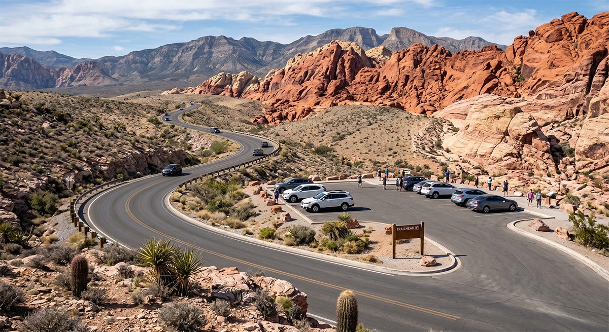
The scenic loop road is the most popular way to explore Red Rock Canyon without hiking. It opens at the Visitor Center entrance and runs one-way through the heart of the conservation area before rejoining Scenic Loop Drive back to the exit.

The road is paved with multiple pullout overlooks, parking areas for specific trailheads, and picnic areas. Driving it slowly with stops at the major points takes approximately 1 to 1.5 hours.

13
Miles long (one-way)
13+
Pullout viewpoints
$15
Entry fee per vehicle
1–2h
Driving time (with stops)

⚠️ One-Way Road Warning

The loop is strictly one-way. If you miss a trailhead parking spot, you must complete the full 13-mile loop before being able to return. Plan your stops in advance.

Red Rock Canyon 13-Mile Scenic Drive Loop Road
Pullouts & Trailheads

Major Stops Along the Loop

Plan your route using this guide to key viewpoints and trailhead parking areas.

1

Calico Hills Overlook

Mile 2

The first major formation you encounter – dramatic red and white Aztec sandstone walls rising directly beside the road. Accessible scrambles for beginners. Popular photography spot.

2

Sandstone Quarry

Mile 3

Former mining site now serving as the main trailhead for Calico Tanks (2.5 miles) and Keystone Thrust (2.4 miles). Large parking area with vault restrooms.

3

White Rock Hills

Mile 4.5

Whitish limestone outcrops contrast with the red sandstone. Trailhead for the White Rock–Willow Spring Loop.

4

Willow Spring Picnic Area

Mile 5

One of the few shaded rest spots on the loop. Picnic tables, restrooms, and access to the Lost Creek Discovery Trail (0.8 miles).

5

Ice Box Canyon

Mile 7

Deep, shaded canyon ravine with a seasonal waterfall. One of the most dramatic canyons on the loop. Parking lot often fills early.

6

Pine Creek Canyon

Mile 10

Shaded canyon with running water, ponderosa pines, and historic homestead ruins. Trailhead for the Pine Creek Canyon Loop (3.0 miles).

7

High Point Overlook

Mile 12

The highest accessible viewpoint on the loop at over 4,700 feet elevation. Spectacular panorama of the entire canyon system and distant Las Vegas skyline.

Best Times to Drive the Loop

Morning (7:00–10:00 AM)

Best lighting for photography. Cooler air temperatures. Parking spots available at major trailheads.

Late Afternoon (4:00–6:00 PM)

Golden hour creates extraordinary light on the sandstone ridges. Popular for sunset photography and landscape shots.

Midday (11:00 AM–3:00 PM)

Bright, flat light. Avoid hiking if possible. Parking areas fill quickly. Not recommended in summer months.

Scenic Drive Tips

Download offline maps before entering. Cell service disappears completely inside the loop.

Gas up in Las Vegas or Summerlin before arriving. No gas stations exist inside the conservation area.

Arrive early on spring weekends. Peak season timed-entry slots sell out completely by Thursday.

Keep your timed-entry reservation QR code downloaded offline to show at the booth without signal.

Pets are permitted in the loop and on most trails but must remain leashed at all times.

Ready to Drive the Canyon Loop?

Book a guided scenic tour from Las Vegas and skip the reservation hassle.

Find Scenic Tours
Find Tours