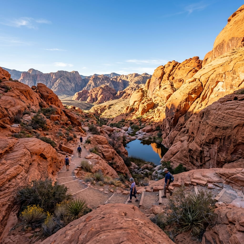
Calico Tanks
Scramble across red sandstone to reach a hidden mountain water tank with panoramic Las Vegas skyline views. The most iconic trail.
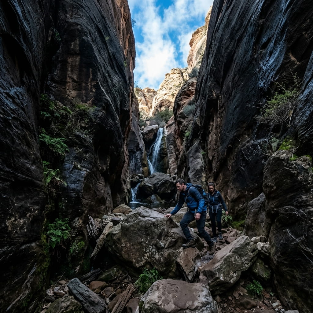
Ice Box Canyon
Descend into a deep shaded gorge with cold water pools and a seasonal waterfall. Requires scrambling over large boulders.
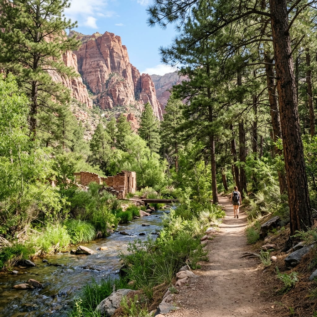
Pine Creek Canyon
A gentle walk through ponderosa pines beside a running creek to a historic homestead ruin. Shaded and beautiful.
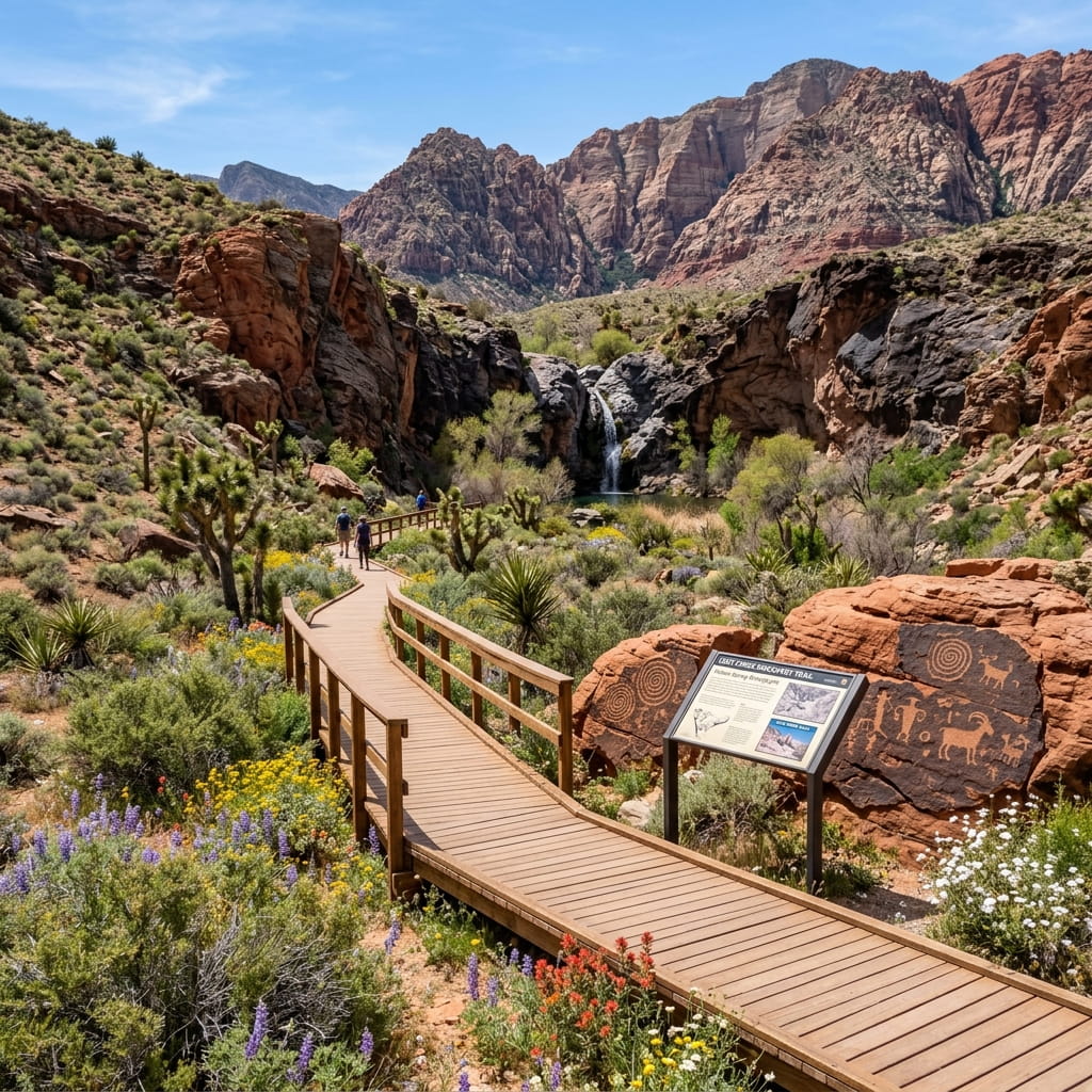
Lost Creek Discovery Trail
Flat boardwalk loop passing desert petroglyph panels, native plants, and a small seasonal waterfall near Willow Spring.
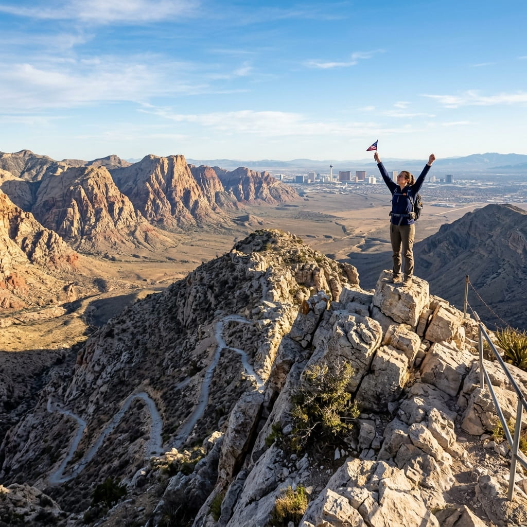
Turtlehead Peak
Steep scramble to the distinctive limestone Turtlehead summit. Panoramic 360-degree views of the entire canyon system.

Moenkopi Loop
Flat desert loop through gypsum soil formations and geological features outside the main loop. No timed entry needed.
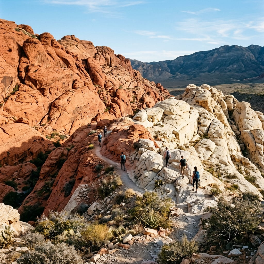
Calico Hills Loop
A scenic loop connecting red and white Aztec sandstone sections. Great for geology enthusiasts and photographers.

Grand Circle Loop
Full perimeter loop around the main Calico Hills area. Requires rock scrambling and navigation skills.
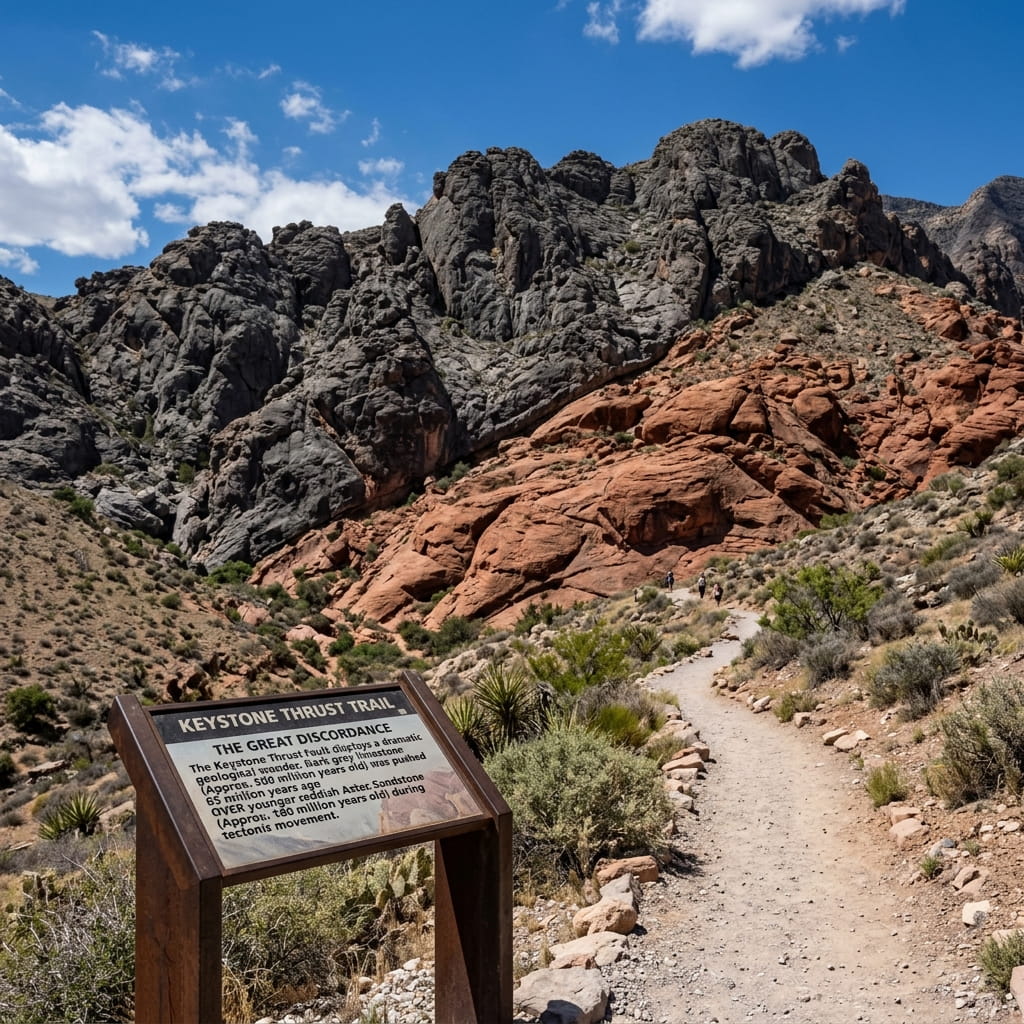
Keystone Thrust
Short walk revealing one of the most significant geological features in southern Nevada – the Keystone Thrust fault.